|
|
| Ancyra (Ankara) |
|
|
|
 |
|
||
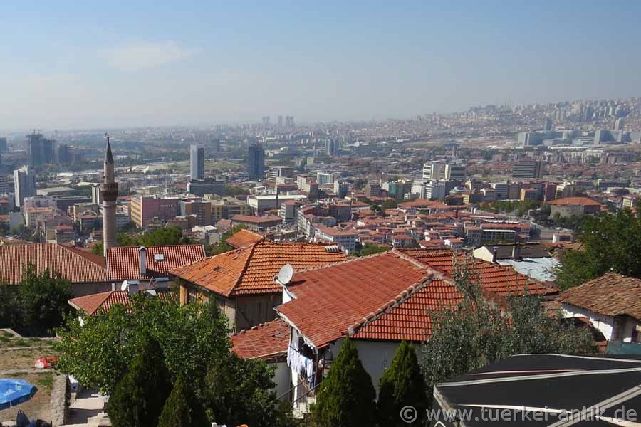
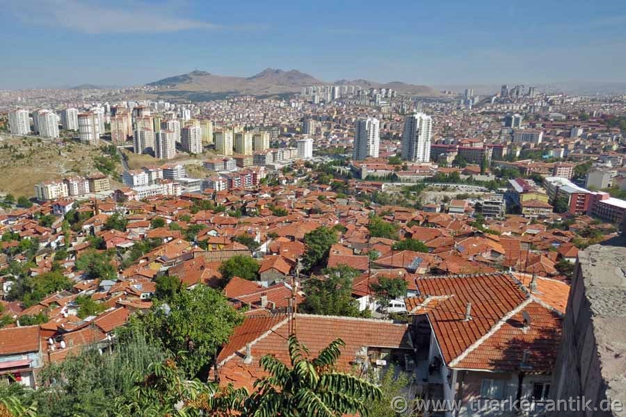
| View of the city from the citadel | |||
|
The exact
etymological origin of the name Ankara is not known. Pausanias
reports that King Midas found an anchor at this place and then
founded the city as Ankyra (Greek for anchor). On the other hand, there are indications that the city name has been used in a similar form since the Phrygians or even the Hittites and was later transformed into Ancyra by the Greeks. Similarly, in the Islamic period of Ankara, the thesis was put forward that the city name Engürü at that time originated from the Persian word for grape (engûr), which referred to the lush wine-growing regions around Ankara. On 28 March 1930, the capital was given the official name Ankara, instead of the Latin alphabet Angora, which had previously been used by Europeans and in trade with Europeans. The Turkish name forms were Engüriye, Engürü or Engüri; earlier name forms were (Old) Greek Ankyra, Latin Ancyra, Arabic Anḳira and Anḳuriyya or Ḳalʿat al-Salāsil. |
|||
 |
|||
| View of the city from the citadel | |||
|
Originally a flourishing
Phrygian settlement on the Persian Royal Road, it became
the centre of the Celtic tribe of the Galatians, who
settled in Asia Minor around 230 BC. In 189 BC Ancyra
was occupied by Gnaeus Manlius Vulso, but remained under
regional rule.
With the final victory of the troops led by Kemal
Atatürk in the Turkish Liberation War, Ankara was
declared the capital because of its location in central
Anatolia and in deliberate demarcation from the Ottoman
capital Istanbul in the run-up to the proclamation of
the republic on 13 October 1923. |
|||
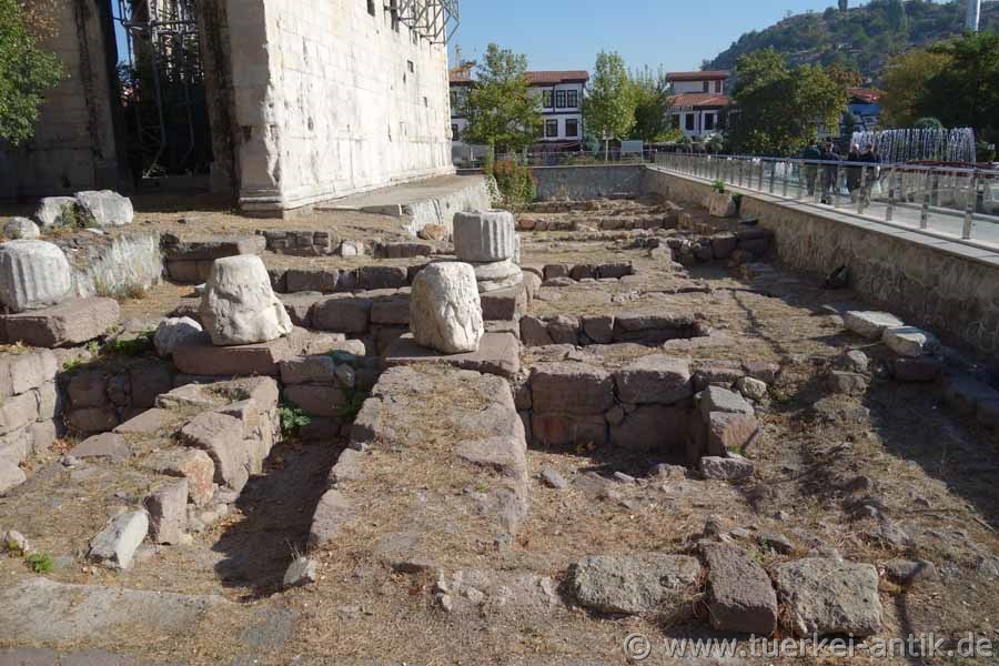
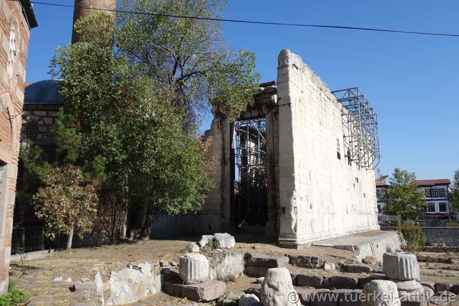
| The Temple of Roma and Augustus |
 |
||
 |
|||
| The Temple of Roma and Augustus | |||
|
The building was originally erected in the 2nd century BC as a temple to the Phrygian deities Men and Kybele. After Ancyra became the capital of the Roman province of Galatia in 25 B.C., the temple was rebuilt and dedicated to the cult of the Roman city goddess Roma and deified Augustus. In the 6th century AD it was rededicated as a church by the Byzantines. The floor of the interior was lowered, the wall between Cella and Rückhalle was replaced by an apse and three windows were built into the southeast wall. In 1427/28 the Hacıbayram Mosque was built at the north-west corner of the temple, whereupon the temple was used as a medrese. |
|||
|
|
|||
|
Built in Corinthian order,
the temple faces northeast and measures about 36 × 55
metres. It stood on a two metre high podium with eight
steps. In front of the narrow side there were 8 columns
and 15 on the long side. Additionally there were four
columns in front of the Pronaos (vestibule) in the
southwest and two columns in front of the Opisthodom. |
|||
| The Column of Julian |
|
||
|
|
|||
| The Column of Julian | |||
|
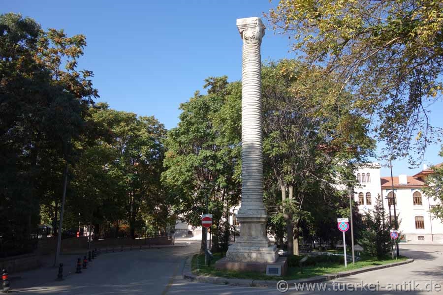
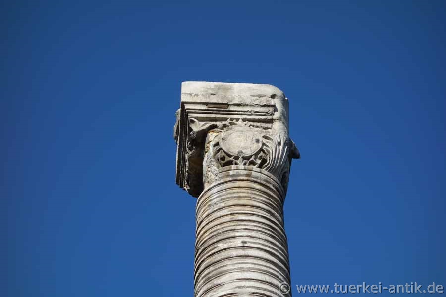
The so-called Julian column (Jülian
Sütunu) is a stone column in the park Hükümet Meydanı. It is located
in the district Ulus. |
|||
|
|
|||
| The Column of Julian | |||
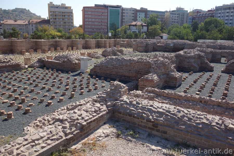
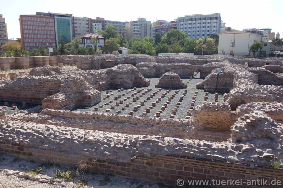
| The Roman Baths of Ancyra |
|
||
|
The Roman bath from the time of the emperor Caracalla (211-217), lies in the historical center of Ankara. It was built on a flat settlement hill, which today rises about 2.5 metres above the road. |
|||
|
|
|||
| On the Palaestra in front of the baths | |||
|
|
|||
|
Today's entrance to the site is to the
east. From there, one first enters the square of the Palaestra,
which occupied approximately 80 × 80 metres. The practice area was
surrounded on all four sides by porticoes with 32 columns each.
These were six metres high, had Corinthian capitals and bore an
architrave with inscriptions. Statues were probably erected in the
eastern entrance area, two rooms each in the north and south could
have been libraries or reading rooms. |
|||
|
|
|||
 |
|||
| The Roman Baths | |||
|
|
|||
|
To the west is the actual bathing building with a floor area of 80 × 130 metres. In the entrance area there is a former covered exercise room, an apodyterium and a frigidarium with swimming pool. Behind it are the Tepidarium (warm water bath), also with a pool, as well as the Caldarium (hot water area) and various ancillary and technical rooms. Apart from the foundation walls, little of the rooms is preserved, but the round brick columns of the Hypocaust underfloor heating can be seen well everywhere. In the north of the Palaestra 17 metres of the Säulenstraße with adjacent shops were excavated, which probably led to the Augustus temple. To the east of Palaestra, near the entrance, there is a Byzantine tomb. The underground tomb was found near Ankara Central Station in 1930 during the construction of an administrative building and moved here. The tomb has two intersecting barrel vaults and dates back to the 3rd/4th century, it has been restored by the Ankara Museum. |
|||
|
|
|||
|
|
|||
|
|
|||
|
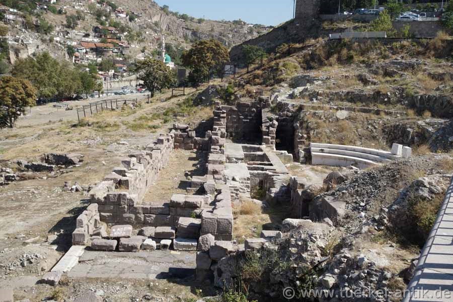
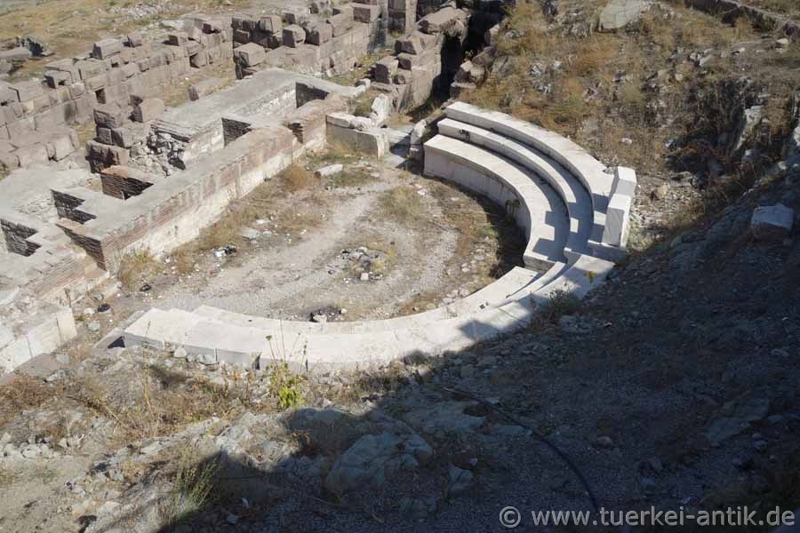
The Roman Theatre |
|
||
 |
|||
 |
|||
|
The probably originally Hellenistic theatre of Ancyra is located - for a long time degenerated and forgotten - on the left side of the road to the citadel, respectively the museum for Anatolian civilizations.
Recently, attempts have been made to reconstruct three rows of seats. Only the foundations of the stage house have survived. All in all, the building, which was abandoned for a long time, is still in a miserable condition. But there is hope. |
|||
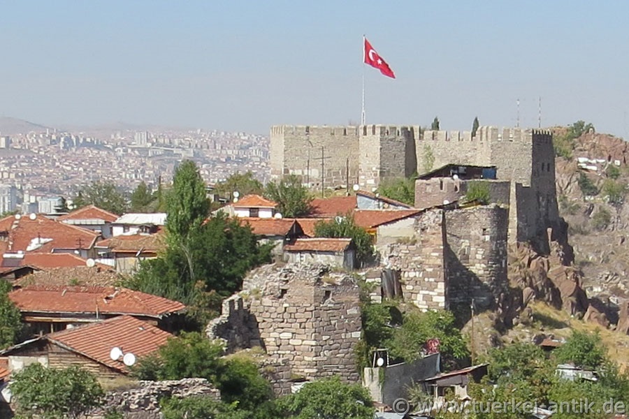
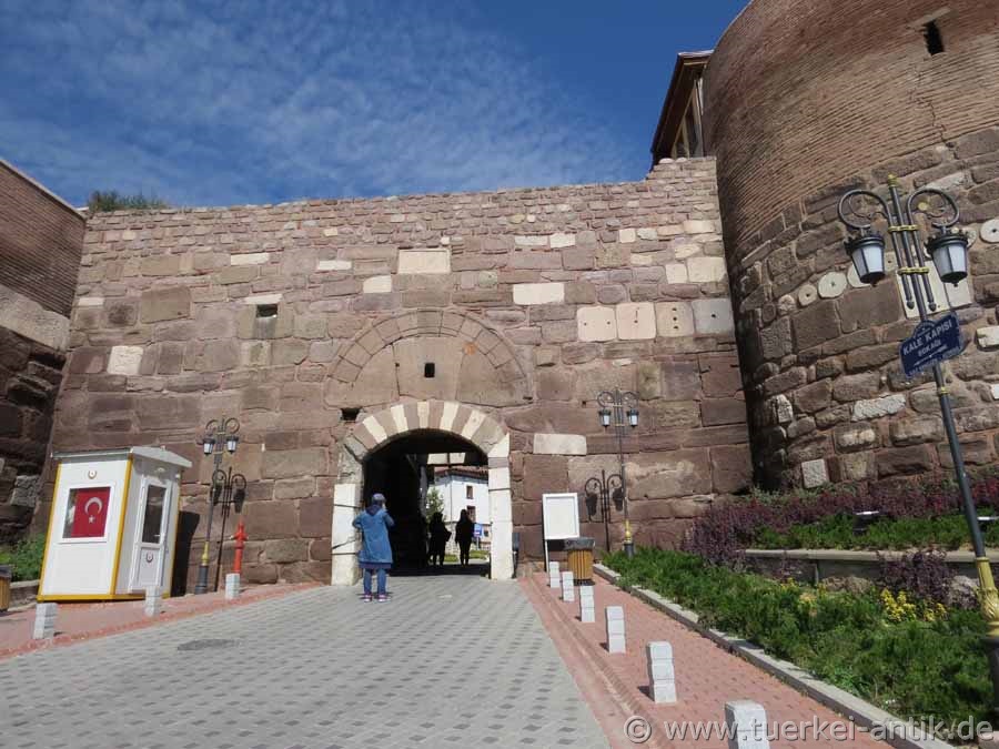
| The Citadel |
|
||
 |
|||
|
The citadel of Ankara was already built by the Hittites as a military garrison. It is situated on a 978 m high hill in the northern part of the present centre of Ankara.
In 25 BC Ancyra became the capital of the Roman province of Galatia. During the Roman rule the citadel was used as an army camp. |
|||
 |
|||
| Entrance to the Citadel | |||
| Photos: @chim, Monika P. | |||
| Translation aid: www.DeepL.com/Translator | |||
| Source: Wikipedia and others | |||
|
|
|||