|
|
| Emirzeli in Cilicia |
|
|
|
 |
|
||
| Roman residential house | |||
|
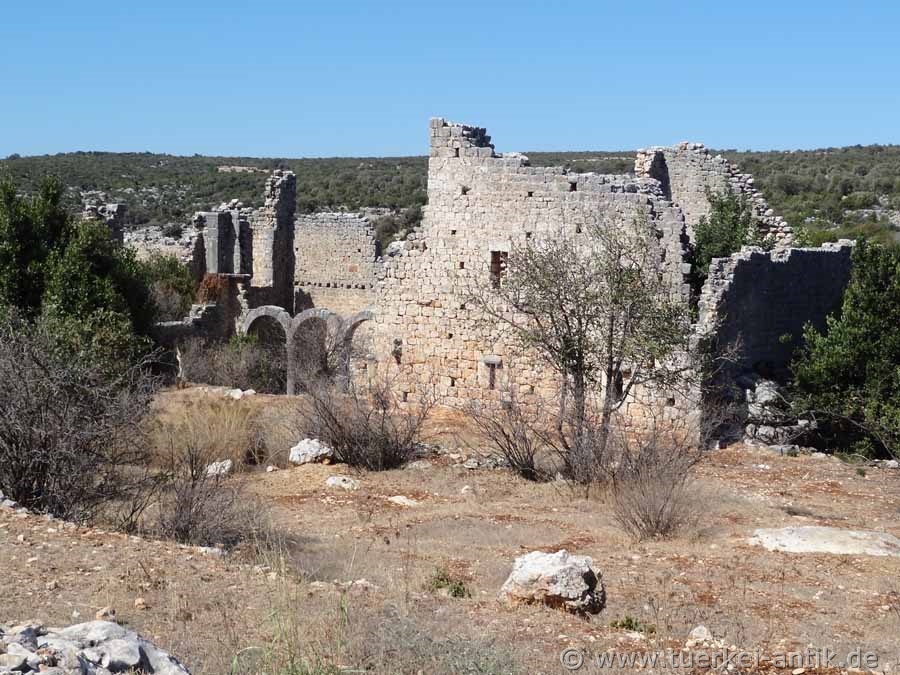
Emirzeli is the Turkish name for a ruined site inhabited from Hellenistic to Byzantine times. It extends on both sides of a hollow. From the former fortification of the settlement few wall remains and a tower are preserved. Slanted below residential houses, on a slope opposite three Byzantine basilicas arranged in a row, as well as the remains of a necropolis. |
|||
|
|
|||
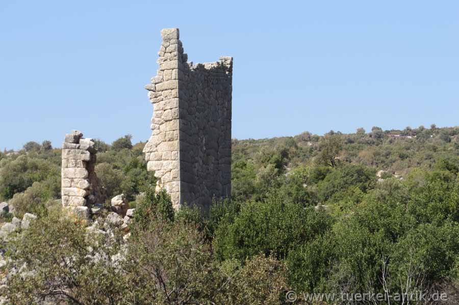
| The Hellenistic tower of the fortifications | |||
|
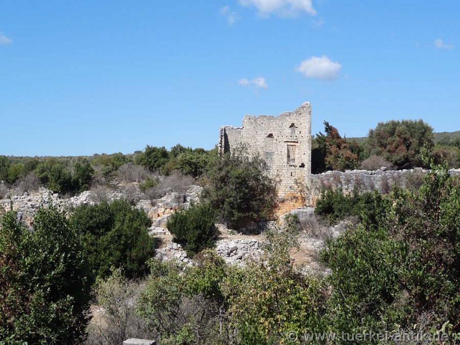
The most striking and at the same time oldest building is a multi-storey tower built in polygonal construction. Due to wall techniques, it can be dated to the end of the 3rd to the beginning of the 2nd century BC. The tower is adjoined to the northwest by remains of a defensive wall, also from Hellenistic times, which continues southwest over the hill. |
|||
|
|
|||
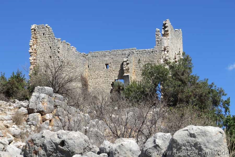
| Manorial residential house | |||
|
About 60 meters south of the tower are the remains of a manor house from the early Byzantine period with at least two floors. Its entrance is on the north-west side, on the lintel a medallion with a cross flanked by two peacocks is incorporated. Inside, the ground floor is divided into two parts by an arch. |
|||
|
|
|||
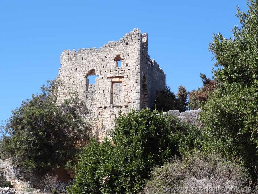
| Manorial residential house | |||
|
|
|||
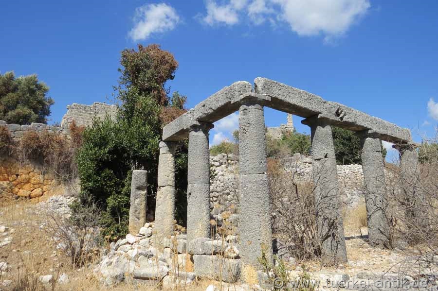
| Peristyl | |||
|
|
|||
|
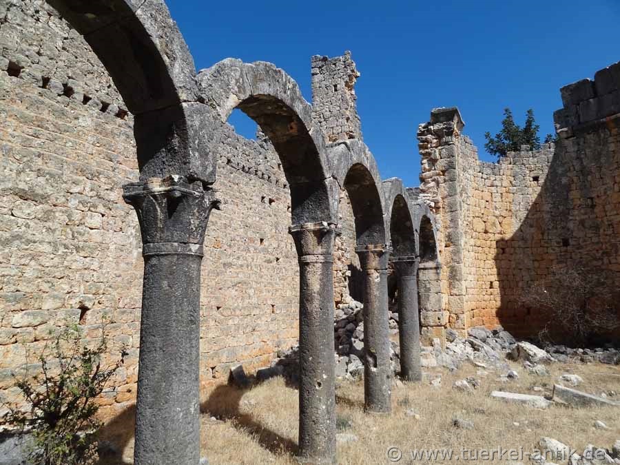
Below this, a peristyle can be seen on the slope, of which three on the narrow side and four uncanneled Doric columns and the architrave are preserved on the long side. It probably belonged to a Roman house. |
|||
|
|
|||
 |
|||
| Rock niches | |||
|
|
|||
|
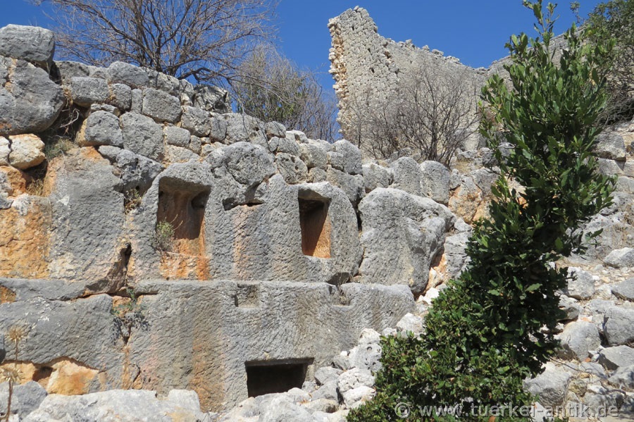
Around the south-western tip of the hill and on the north-western side are still the ruins of numerous buildings that can no longer be defined, some of them built in polygonal masonry and thus probably at the same time as the tower. Beneath the manor house, niches are embedded in the rocks. They are probably graves. |
|||
|
|
|||
|
|
|||
|
Church II |
|||
|
|
|||
|
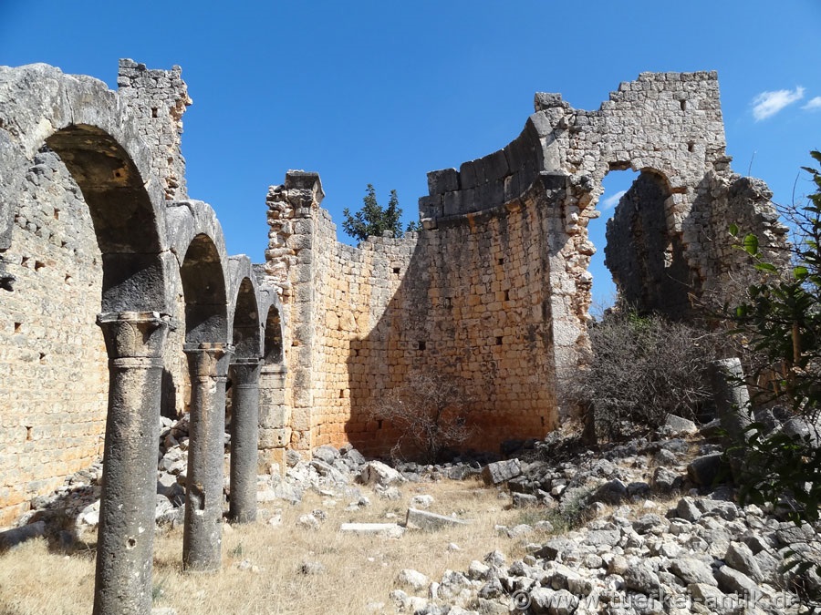
On the southern opposite slope, below the modern street and the hamlet of the same name, lie the remains of three church buildings, which are called Church I to Church III. Church I, the largest of the three, probably had three naves. Nothing of the interiors has been preserved, the main apse still stands in the northeast. Church II is the most completely preserved. Here, too, it is a three-nave basilica with narthex. The building is built on a plateau sloping to the northwest, little is preserved of the southeast wall. Three entrances to the three naves lead from the two-storey narthex, which is largely destroyed except for the north-west wall. |
|||
 |
|||
| Church II | |||
|
The aisles are separated from the nave by rows of columns with arcades. On the ground are two fallen cuboids, on which an inscription indicates a Georgios Paulos as founder. Beam holes in the walls indicate the presence of galleries above the aisles. |
|||
 |
|||
| Church II | |||
|
Remarkable are the two-storey side rooms next to and behind the apse. Two approximately right-angled rooms are located to the right and left of the apse.
A Turkish Byzantine woman who explored the church at the end of the 1990s suggested that the basilica might have been a pilgrimage church. Some architectural peculiarities could indicate that. The Thekla Church in the Ayathekla Shrine near Silifke, which was a well-known place of pilgrimage in the 5th and 6th centuries, could serve as a model. Aydin dates Church II to the same period because of its construction techniques and capitals. |
|||
| Photos: @chim, Monika P. | |||
| Translation aid: www.DeepL.com/Translator | |||
| Source: Wikipedia and others | |||
|
|
|||