|
|
 |
||
|
|
|
|
||
|
|
||||
|
The Greeks, Romans, Byzantines and finally the Seljuks built a road network on the territory of present-day Turkey, some of which is still in use today. For this purpose brooks and rivers had to be crossed, i.e. bridges had to be built. Many of these bridges have survived the centuries - repeatedly repaired and restored. The Roman road network covered more than 100,000 kilometres throughout the Roman Empire and served primarily military purposes. However, it was these roads that facilitated trade between cities and regions far apart from each other and became increasingly important. The bridges were therefore of particular importance. The Byzantines took over the existing (western) Roman roads and bridges and extended them. The Seljuk bridges served less military purposes than the safe crossing of often torrential mountain streams and rivers on the caravan routes. |
||||
|
Other bridges in preparation |
||||
|
Aizanoi (today Çavdarhisar) |
|
|
||
|
|
||||
 |
|
|||
 |
||||
|
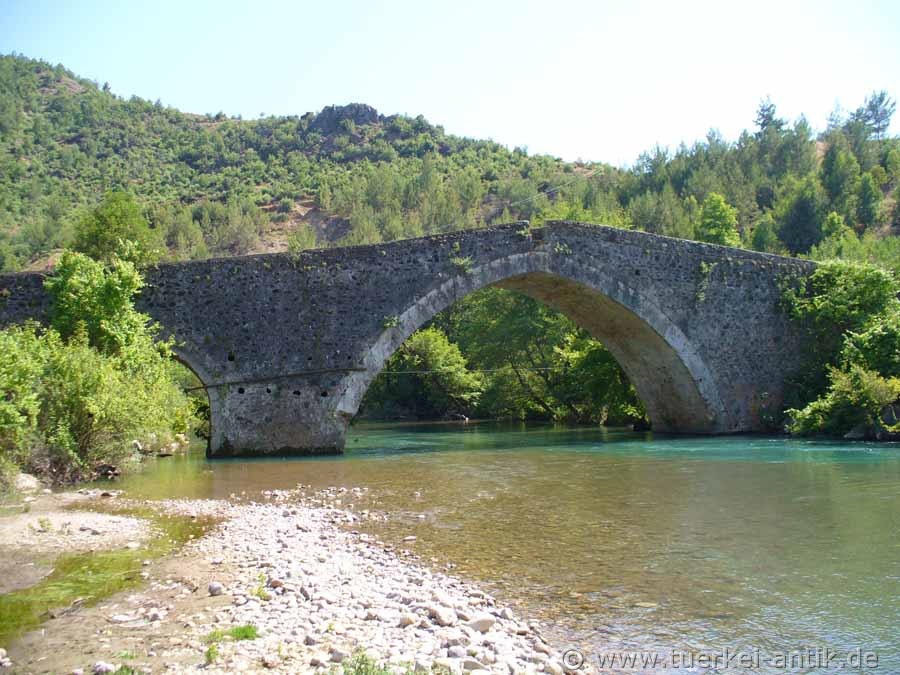
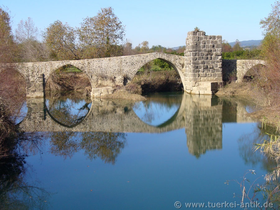
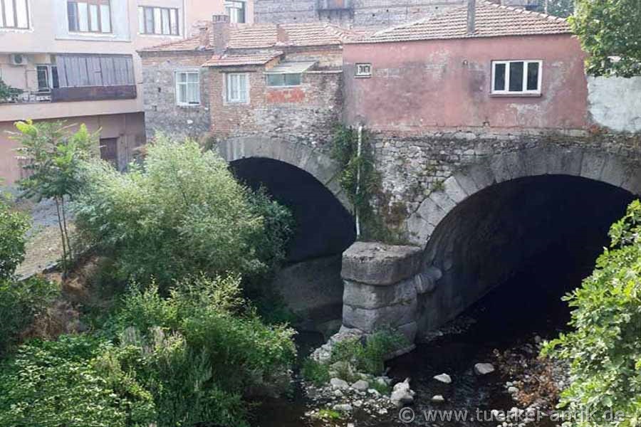
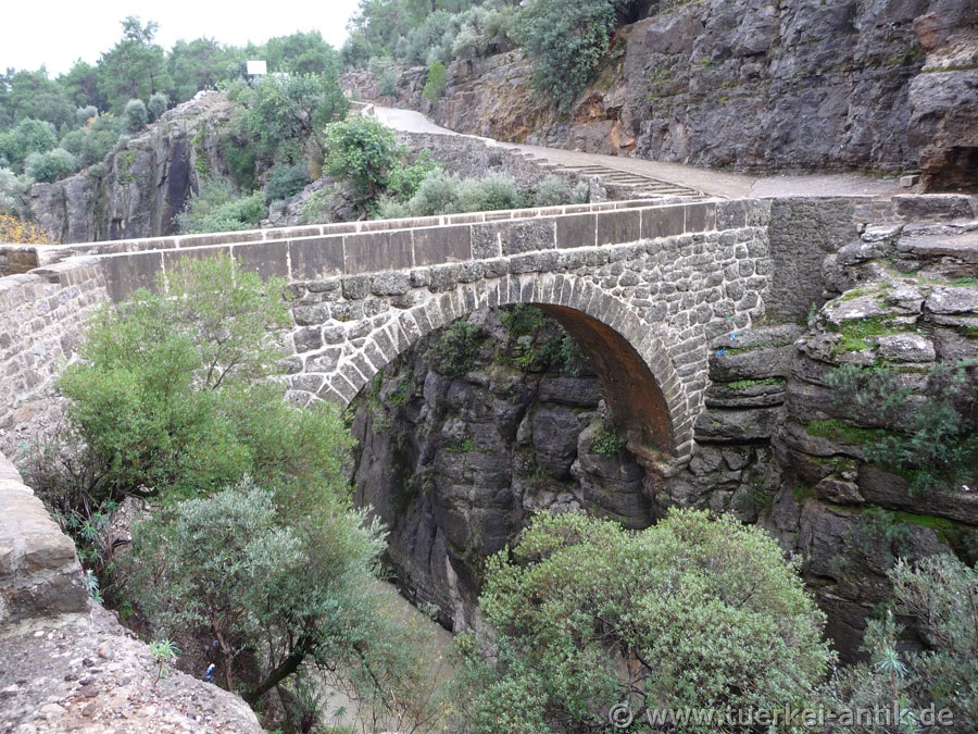
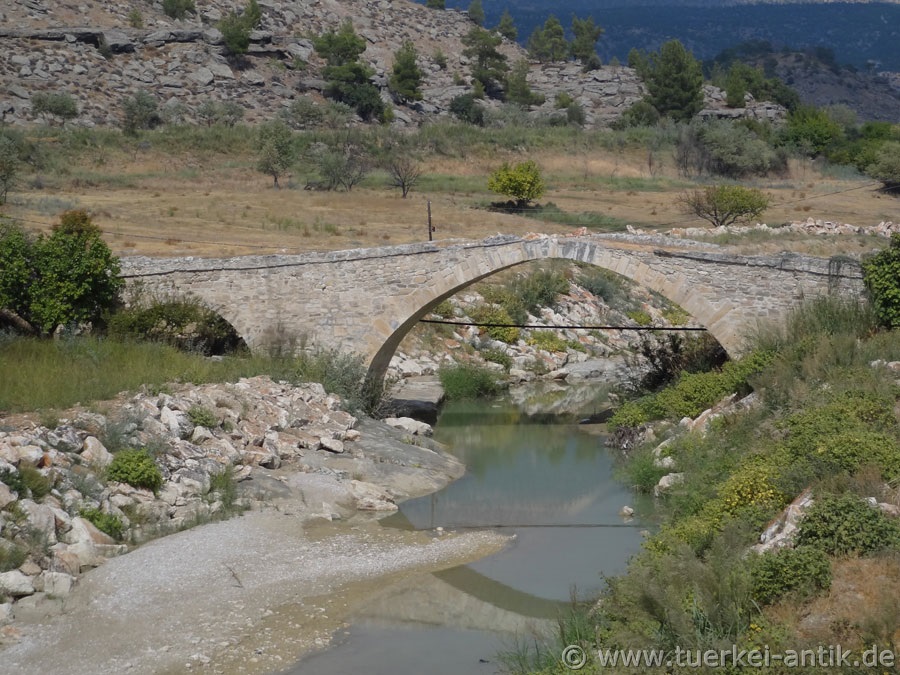
Roman bridge over the Penkalas Two of the formerly four Roman bridges from the 2nd century AD still span the Penkalas (today Bedir Çayı), a small tributary of the Kocaçay (Rhyndakos). While the balustrade of the five-arched stone bridge (the illustration shows the three-arched bridge) was preserved until at least 1829 according to reports of early European explorers, it has now been replaced by an unsightly iron railing. All traffic through the village now crosses this bridge. It was probably the most important river crossing in ancient times due to its central location near the sanctuary of Zeus and the direct connection to the highway to Kotiaion (today's Kütahya). |
||||
|
Anamur |
|
|||
 |
||||
 |
||||
|
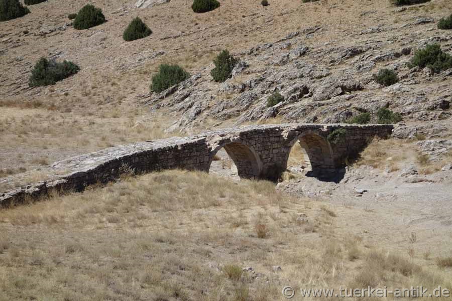
Alaköprü bridge The historical bridge Alaköprü over the Anamur Çayı was built in the 13th century by the Karamanids (a Turkish principality with a centre in today's Karaman province). It is located about 12 km north of the city of Anamur. A few 100 meters to the north is the dam of the same name. |
||||
|
Aspendos (Belkis) |
|
|||
 |
||||
|
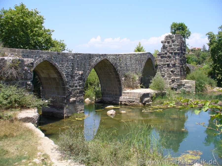
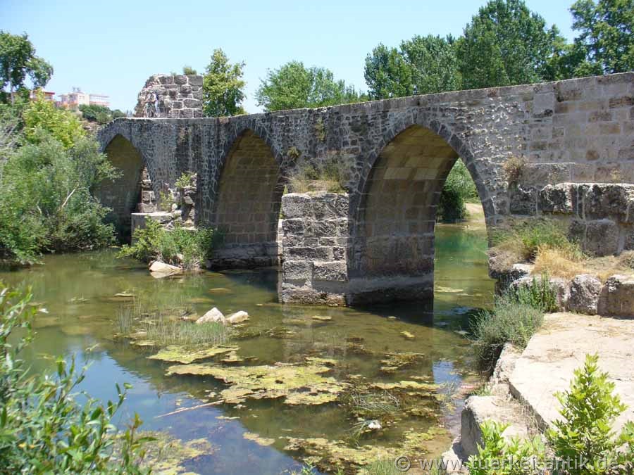
Eurymedon Bridge near Aspendos The Eurymedon Bridge near Aspendos was a bridge with nine arches from Roman times over the Eurymedon (Köprüçay). Today the Köprüpazar Köprüsü, a Seljuk pointed arch bridge with Roman spoils, rests on the foundations of the ancient building. Following the remains of Roman piers in the riverbed, the bridge has a striking leap in the middle.
The chronological classification of the Roman bridge must be closely linked to the well-known aqueduct in nearby Aspendos, from which part of the building material was taken. For example, around 250 perforated blocks from the Aspendos pressure pipeline were reused as spolia in the external formwork of the bridge alone. |
||||
|
Köprüköy/Erzurum |
|
|||
 |
||||
 |
||||
|
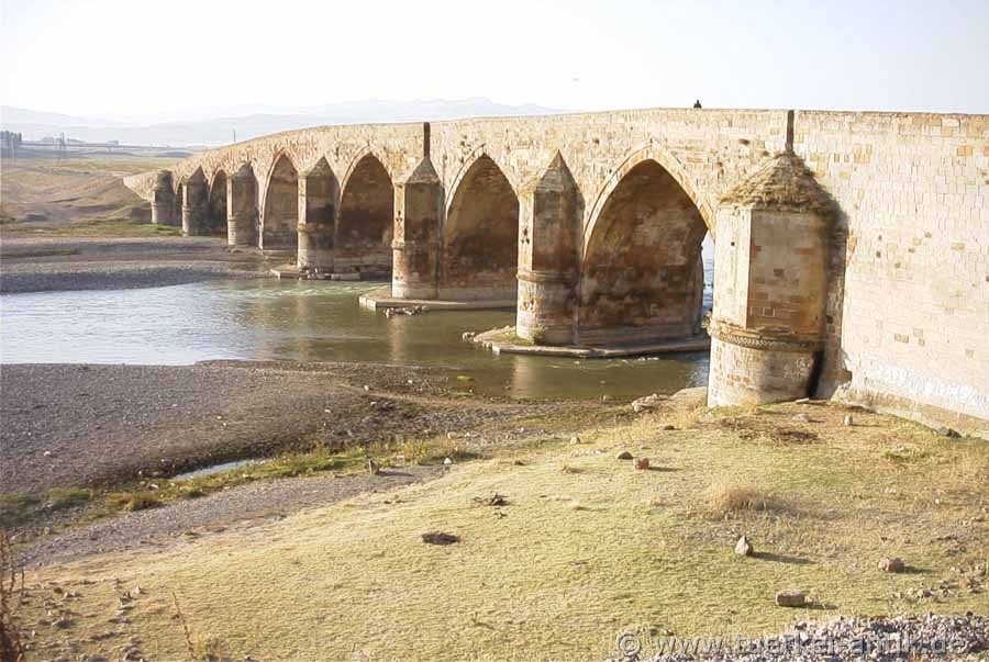
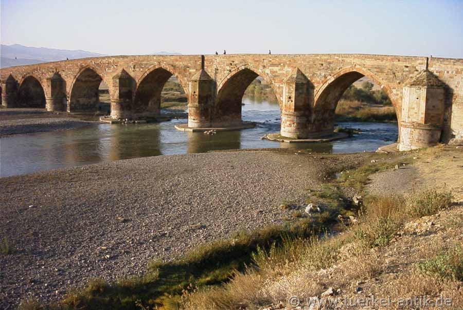
Çobandede Bridge The 200 metre long Çobandede bridge bridges the Aras River near Köprüköy between Horasan and Pasinler, directly next to the European road 80. The bridge dates from the time of the Ilchane (Mongolian provincial princes) and was built by Amir Tschupan in 1297. |
||||
|
Limyra |
|
|||
|
|
||||
 |
||||
 |
||||
|
The ends |
||||
 |
||||
|
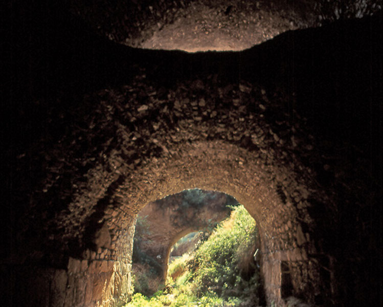
Kırk Göz Kemeri The Roman bridge near Limyra (Turkish Kırk Göz Kemeri) is one of the oldest segmental arch bridges in the world. It was probably built at the end of the 2nd or 3rd century.
The 360 m long stone bridge crosses the river Alakır Çayı near the ancient city of Limyra. Its 26 segment arches are mostly buried today. They have an arrow ratio of 5.3 to 6.4 to 1, which gives the building an extremely flat profile and was only reached again in the late Middle Ages (for example at Ponte Vecchio) with 6.5 to 1. Despite its outstanding technical-historical importance, the bridge near Limyra is little known; the increasing destruction of the structure prompted the German Archaeological Institute (DAI) in the 1970s to carry out the only field investigation to date. |
||||
|
Manavgat |
 |
|||
 |
||||
 |
||||
 |
||||
|
Naras Köprüsü The Naras Bridge was part of a Roman road from the Pamphyl Side to the Lyrbe over the Naras, a tributary of Melas, about 20 km away. Melas was the ancient name for the Manavgat Çay. The bridge was restored in the early 1990s. |
||||
|
Nysa |
|
|||
 |
||||
|
The bridge of Nysa
The bridge of Nysa is a Roman river overpass over the Cakircak stream in Nysa (Caria), today's Sultanhisar. The 100 m long tunnel-like superstructure from the late imperial period was the second largest of its kind in ancient times after the one in Pergamon. |
||||
|
Pergamon |
|
|||
 |
||||
|
The bridge of Pergamon The bridge of Pergamon is a Roman river overbuilding in the ancient city of Pergamon (today: Bergama). The double tube under the forecourt of the Red Hall is with a length of 183 or 196 m by far the largest river superstructure of antiquity. At the time of Hadrian (r. 117-138 A.D.) a considerable part of the city river Selinus (today: Bergama Çayı) was bridged, to create space for the forecourt of the Temple of Egyptian Deities (also known as Serapis Temple or Red Hall). |
||||
|
Seleukia ad Calycadnum (today Silifke) |
|
|||
 |
||||
|
The Roman Bridge over the Göksu
The bridge over the Göksu (ancient name Saleph and Kalykadnos) was built in 77/78 by the proconsul governor of the province of Cilicia, Lucius Octavius, in honour of Emperor Vespasian and his sons Titus and Domitian. The dedication inscription was lost in 1922 during the fire at the Museum of the Protestant School in Izmir, which was given as a gift by the Greek inhabitants of Silifke in 1870. |
||||
|
Selge |
|
|||
 |
||||
 |
||||
|
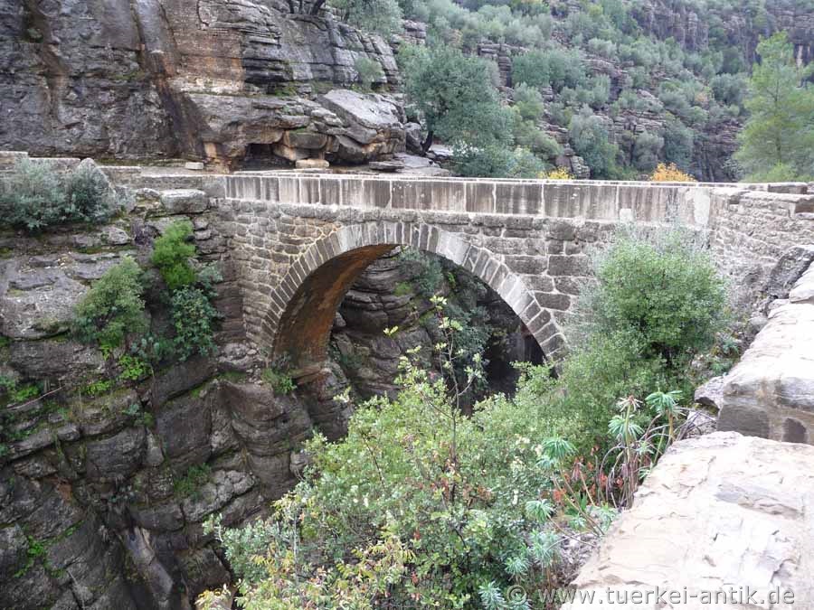
Eurymedon bridge near Selge The Eurymedon Bridge (Turkish: Oluk Köprü) is a Roman bridge over the Eurymedon (today Köprüçay) near the ancient town of Selge in Pisidia. It belongs to a road connection that winds up from the coast of Pamphylia into the Pisidian hinterland. Located in a sparsely populated area, the bridge crosses Eurymedon 5 kilometres north of the town of Beşkonak.
The excellently preserved and still passable structure is 14 metres long and 3.5 metres wide (roadway: 2.5 m). The clear width of the single arch is approx. 7 metres, the thickness of the wedge stones joined together without mortar is 60 centimetres. The building technique and the robust construction of the masonry indicate a construction period in the heyday of Selges in the 2nd century AD. |
||||
|
Silvan |
|
|||
 |
||||
|
Malabadi-Bridge
The Malabadi Bridge (Turkish: Malabadi Köprüsü) is an arched bridge spanning the Batman River near the city of Silvan in southeastern Turkey. |
||||
|
Justinian Bridge (Tarsus) |
|
|||
 |
||||
 |
||||
 |
||||
|
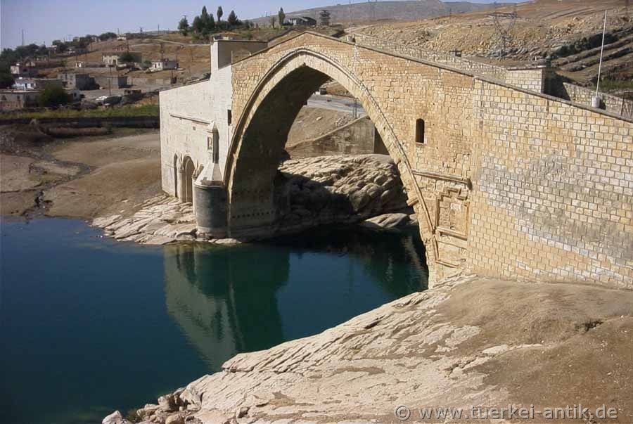
Justinian-Bidge
The bridge was named after the Byzantine emperor Justinian, who had it built during his reign (527 - 565 AD). The name "Toll Bridge" originated at the time when the caravans crossing the river had to pay their tribute at the bridge. |
||||
|
Ancient Bridge (near Mut) |
|
|||
 |
||||
|
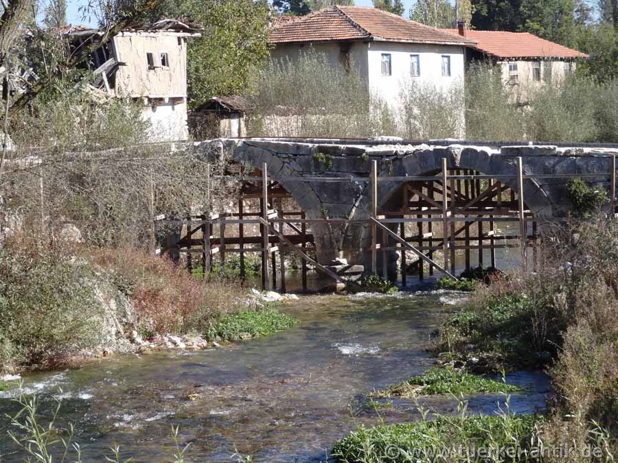
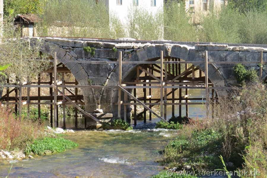
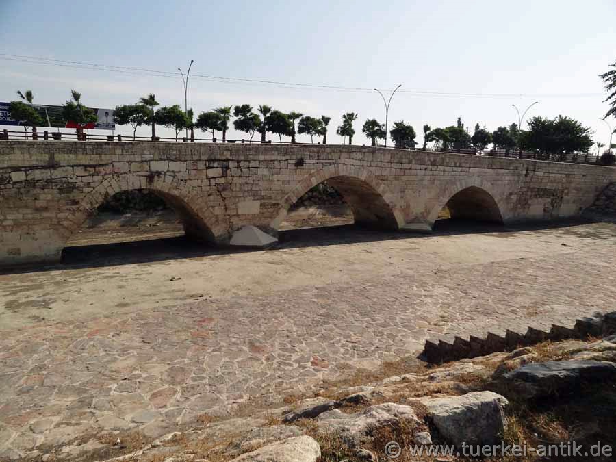
Ancient bridge by Mut The bridge is located next to the national road D715, Silifke - Karamanmaraş, about 5 km north of Mut. Further information about this bridge could not be found. |
||||
|
Ancient Bridge (near Kilistra/Lystra) |
|
|||
 |
||||
|
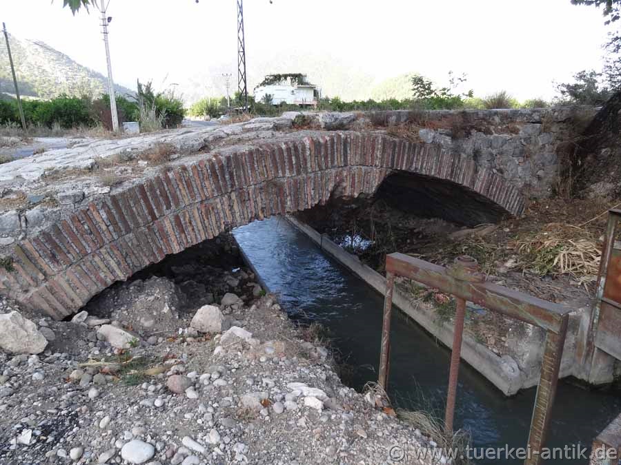
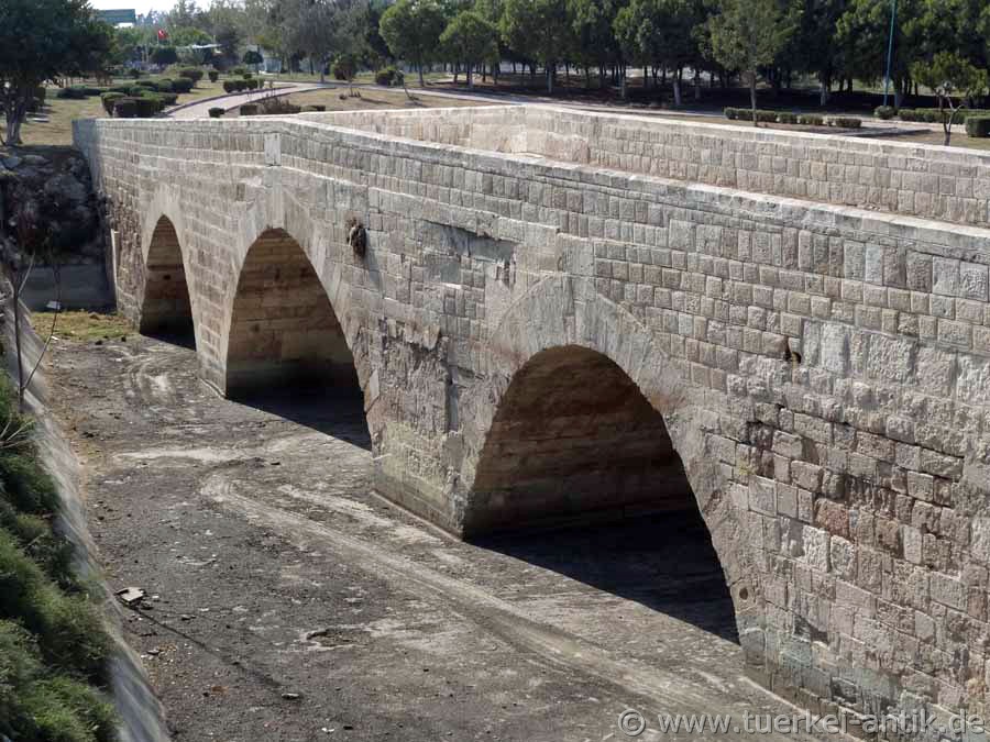
Kumralı Köprüsü The probably Roman bridge is located at the Osmanlı Cad, between Gökyurt (Kilistra / Lystra) and Konya, about 9 km to Gökyurt. More information about this bridge could not be found. |
||||
|
Photos: @chim, Monika P. |
||||
|
Translation aid: www.DeepL.com/Translator |
||||
|
Source: Wikipedia and others |
||||
| Other bridges in preparation |
 |