|
|
| Çatalhöyük in Lycaonia |
|
|
|
 |
|
||
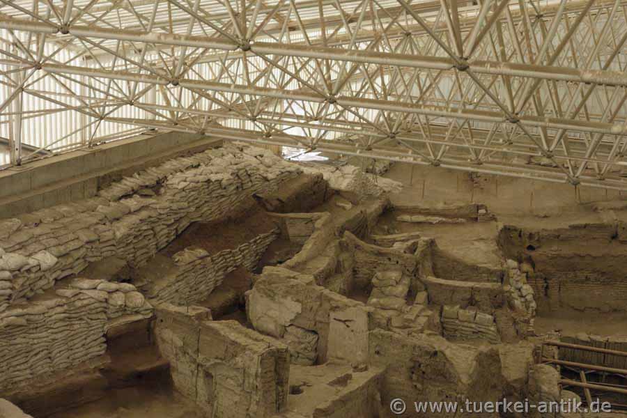
| North Shelter of 2008 | |||
|
Çatalhöyük (Turkish çatal "fork" and höyük "hill") is a settlement from the Neolithic period excavated in today's Turkey. It is dated to the period between 7500 and 5700 BC and its heyday around 7000 BC. The settlement had several thousand inhabitants. Çatalhöyük has been a UNESCO World Heritage Site since 2012. |
|||
|
|
|||
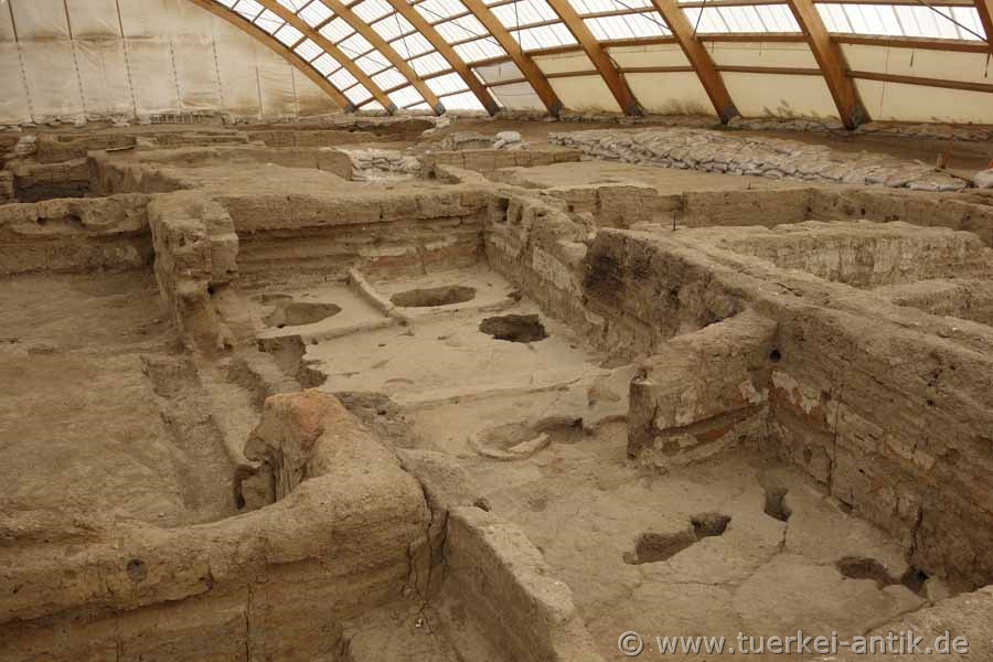
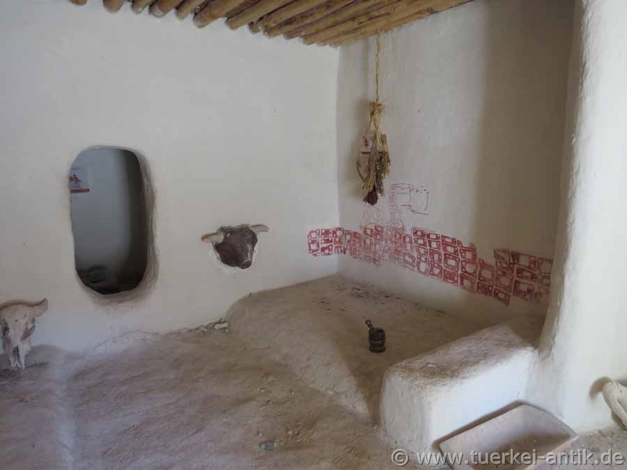
| Burial openings under the floor | |||
|
Many, but not all, houses contained burials. Newborns and infants were mostly buried in the south of the house, where there were also stoves and ovens, adults under the sleeping platforms in the north of the house. |
|||
|
|
|||
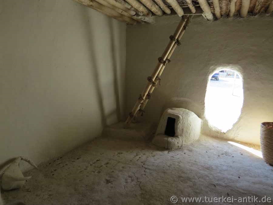
| View to the north to the entrance | |||
|
The settlement consisted of rectangular mud brick or rammed earth houses with flat roofs, which were placed close together. Different room heights and floor levels ensured ventilation and light supply for the individual buildings and created a stair-like nesting. There were no streets, alleys or passageways between the individual houses. |
|||
|
|
|||
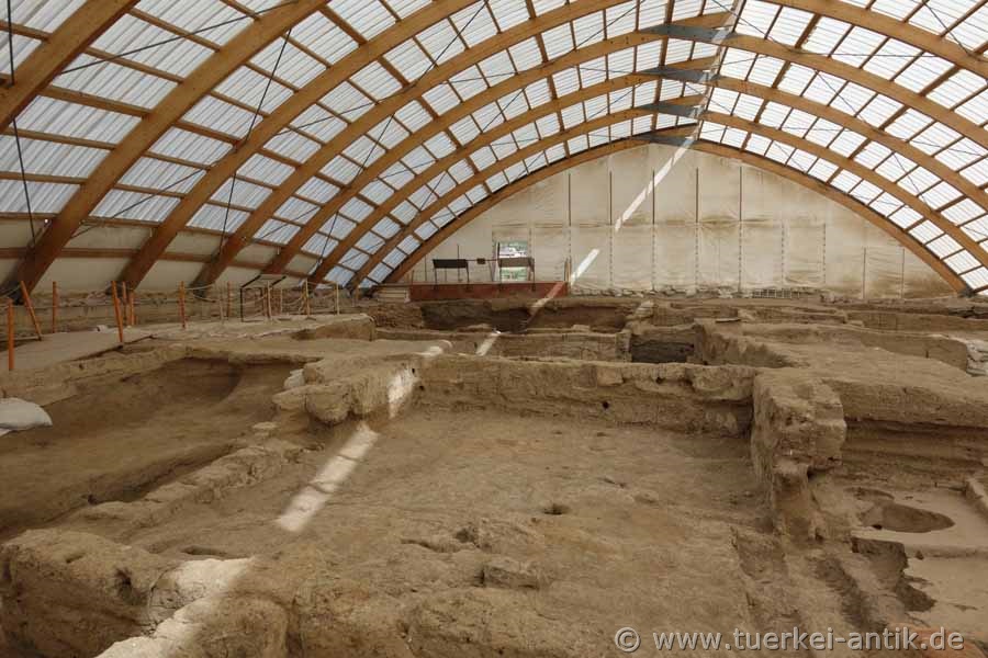
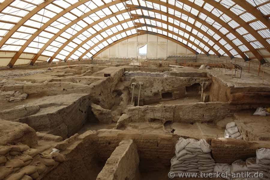
| South Shelter | |||
|
The settlement was discovered in the late 1950s. Between 1961 and 1965, the British archaeologist James Mellaart of the London Institute of Archaeology uncovered the remains of more than 160 houses that now lie under the south roof. In 1965 the excavation work was stopped due to unpleasant occurrences around James Mellaart. |
|||
|
|
|||
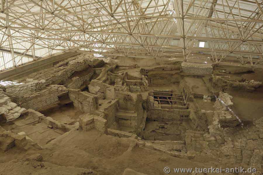
| South Shelter | |||
|
|
|||
|
The work was resumed in 1993 as part of an international research project.
In the first phase, 1993-1995, mainly surface investigations were carried out. |
|||
|
|
|||
|
Replica in the visitor centre |
|||
|
Mellaart defined 14 layers belonging to the PPNB (8800-7000 BC) and the ceramic Neolithic of Central Anatolia. According to radiocarbon dating, these layers existed between 7500 and 6200 BC. The deep cut dates between 7400 and 7000 BC. |
|||
 |
|||
| Replica in the visitor centre | |||
|
|
|||
|
The settlement of the northern hill ended around 6500 BC. In Roman and Byzantine times cemeteries were built on both hills. The settlement site near the river Çarşamba was well chosen: Water was available to a sufficient extent, an important location factor in the Konya plain with low precipitation. The natural food supply around Çatalhöyük was correspondingly rich (wild game, collective fruits). The favourable conditions probably brought the local population together in Çatal Höyük and caused the enormous expansion of the settlement for this period. |
|||
|
|
|||
|
|
|||
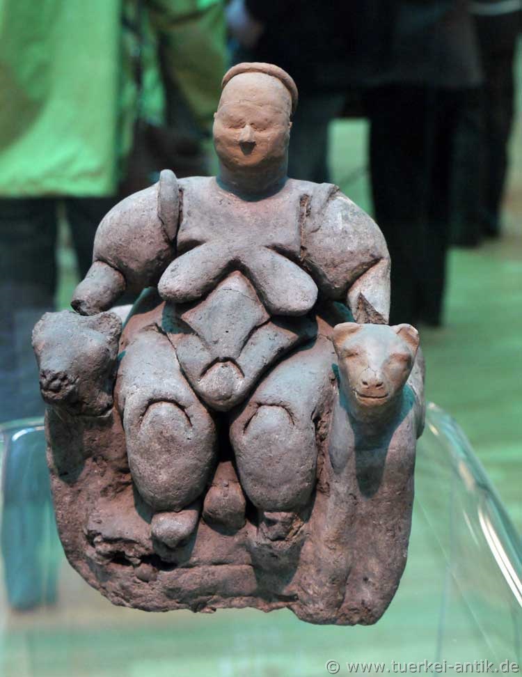
|
"Venus of Çatalhöyük" l Mother Goddess around 5750 B.C. l Museum of Anatolian Civilizations Ankara |
|||
| Photos: @chim, Monika P. | |||
| Translation aid: www.DeepL.com/Translator | |||
| Source: Wikipedia and others | |||
|
|
|||